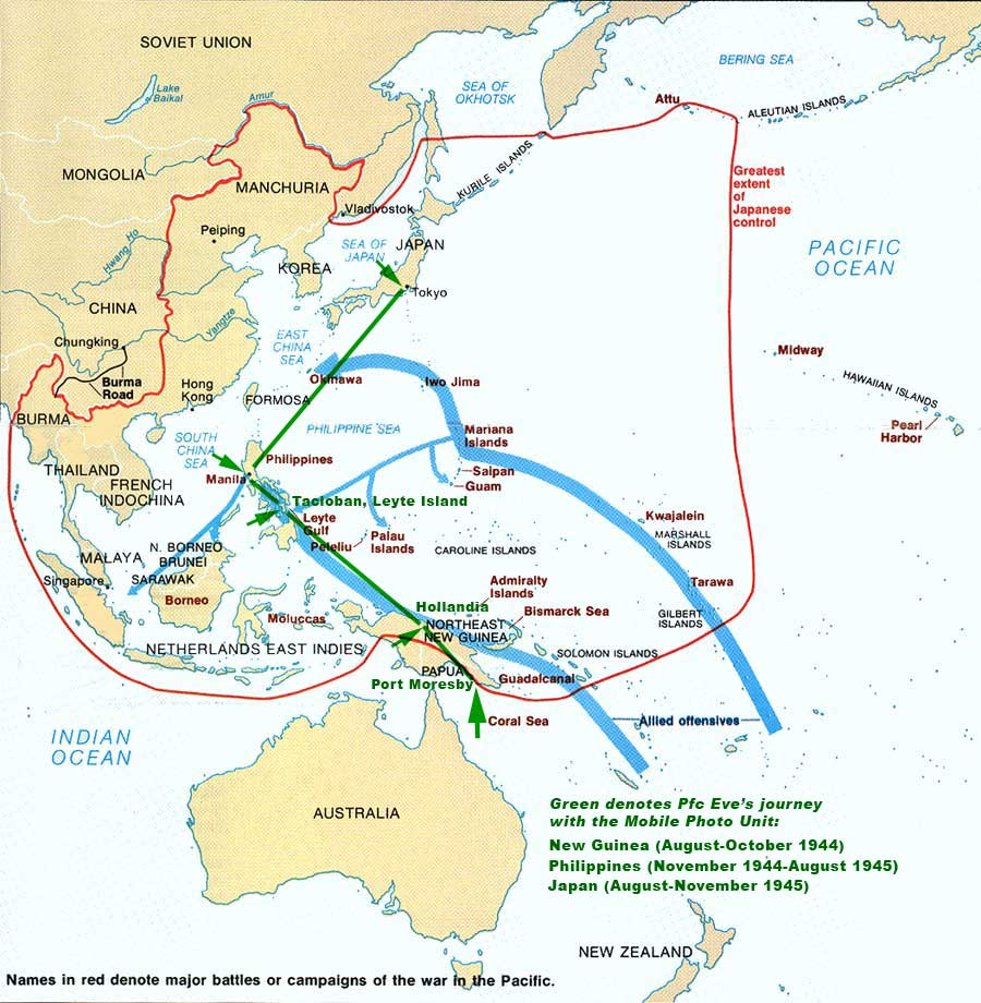
Map of the Pacific Campaign

Ten hours after they bombed Pearl Harbor on December 8, 1941, Japanese forces attacked two American airfields in the Philippines. They destroyed most of the U.S. P-40 fighters and B-17 bombers stationed there, as well as many other military planes.
In August 1944, the American liberation forces assembled in New Guinea to launch a counteroffensive. Pfc Eve was among them. Two months later they arrived on Leyte, a large southern Philippine island.
The landing of the American forces on Leyte on 20 October 1944 brought to fruition the long-cherished desire of General Douglas MacArthur to return to the Philippine Islands and avenge the humiliating reverses suffered in the early days of World War II. The successful conclusion of the campaign separated the Japanese-held Philippine Archipelago into two parts, with a strong American force between them.
From Leyte: The Return to the Phillipines by M. Hamlin Cannon,
available on Gutenberg
After Leyte, the U.S. forces took Manila. From there they proceeded to Tokyo. You can follow their advance on the map above: names in red denote major battles or campaigns of the Pacific War and those in green show the route taken by Pfc Eve and the Mobile Photo Lab Unit:
New Guinea (Aug-Oct 1944)
Philippines (Nov 1944-Aug 1945)
Japan (Aug-Nov 1945)
Map Credit: War in the Pacific National Historical Park
Related:
- Combat History of the Mobile Photo Lab by Capt Harold C. Herman.
- Other Photo Corps Members.
- Flowers for the Living, a tribute written for the Mobile Photo Lab by Washington Post correspondent Allen Raymond.